

the Dutch Caribbean island of Curaçao in live 3D
software by 3D State
| Sorry! For some people these links work (with Internet Explorer only), for others they don't. Please don't be mad at us if you're one of the unlucky ones - we have been trying to figure out what's going on with the software manufacturers, to date without much success. Thank you for your patience. |
| Curaçao island, 1499 | upon European discovery by Alonso de Ojeda simulation area 65x24 km - 368.7 Kb | |
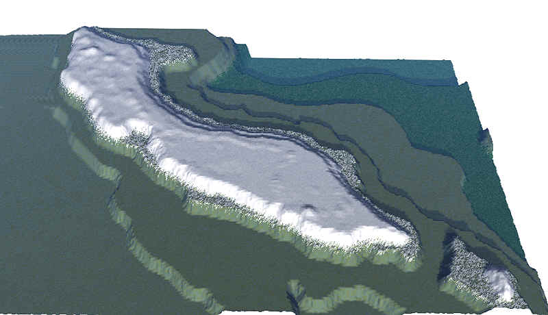
| Christoffel National Park | around 375 m Christoffelberg in the West simulation area 3200x3200 m - 882.4 Kb |
These two use 3D State technology.
right-click your mouse to open the links above in a new window;
close that window to return to this page
| tiny top | — | large mountain |
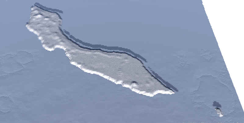 |  | |
Elevations from -2000 m to +375m
made with Geomantics' Genesis II (now down the drain)
Frankly, we have to agree that the techniques used by Google Earth are much more advanced than what we have to offer. We are in a new phase of development and hope to be able to work something out with Google later.
Our next simulations are in Virtual Reality (VRML).
Get a taste here!
Not in 3D:

geography, culture, exploration
Anaglyph 3D

how real 3D works
| more 3-D simulations | made with Internet Space Builder |
 |
 |

stereo photographs

this page is perpetually

SEARCH this site or the Web

 copyright notice
all material on this site, except where noted
copyright © by , curaçao
reproduction in any form for any purpose is prohibited
without prior consent in writing